
 Overview
The Pan Borneo Highway represents one of Southeast Asia's most ambitious infrastructure projects, connecting the Malaysian states of Sabah and Sarawak with Brunei while facilitating future links to Indonesia's Kalimantan region. This report focuses specifically on Sarawak's section of this transboundary highway system, which stretches across Malaysia's largest state, covering its diverse landscapes from coastal cities to remote rainforest interiors. As the backbone of Sarawak's transportation network, the highway plays a pivotal role in economic development, tourism accessibility, and regional connectivity. We will examine its historical evolution, route specifics, tourist attractions along its path, current construction status, practical travel advice, and the rich cultural tapestry of communities living along this vital corridor. With completion expected by 2026, the highway is transforming travel experiences while raising important questions about balancing development with environmental conservation in one of the world's most biodiverse regions.
Key Facts
- Total Length in Sarawak: 1,077 km
- Completion Status: 99% complete (as of April 2025)
- Expected Full Completion: 2026
- Design Standard: JKR R5 (100 km/h design speed)
- Major Cities Connected: Kuching, Sibu, Bintulu, Miri, Limbang
Historical Background
The genesis of Sarawak's Pan Borneo Highway traces back to the post-World War II
era when the British colonial administration recognized the urgent need for
improved transportation infrastructure in Borneo. After Sarawak became a British
Crown Colony in 1946, the colonial government initiated plans for an intercity
highway network to connect the state's scattered population centers and
facilitate economic development. The first major trunk road project, known as
the "First Trunk Road," commenced construction in 1965, marking the beginning of
systematic highway development in Sarawak.
Following Sarawak's participation in the Federation of Malaysia in 1963,
infrastructure development gained momentum. Throughout the 1960s to 1980s,
Sarawak's highway network expanded significantly, with key sections being
completed during this period. The Lawas-Merapok-Sindumin section reached
completion in 1981, while the crucial connection between Sibu and Bintulu--a
vital economic corridor--was finalized in 1985. However, these early roads were
not fully paved with asphalt; it wasn't until the conclusion of Malaysia's Sixth
Plan (RMK6) in 1995 that the entire Federal Route 1 in Sarawak received complete
asphalt surfacing.
A significant milestone occurred in 1996 when all routes within Sarawak's Pan
Borneo Highway network were officially re-gazetted as federal highways under the
Federal Roads Act 1959, receiving the designation FT1. This recognition elevated
the highway's status within Malaysia's national transportation framework. The
route was subsequently incorporated into the Asian Highway Network as Route
AH150, acknowledging its importance for regional connectivity.
For decades, the Pan Borneo Highway in Sarawak was notorious for its
inconsistent quality and safety standards. Many sections were built to minimal
specifications (JKR R3 standard) with design speed limits of just 70 km/h and
narrow 3.0-meter lanes. The highway's poor condition--characterized by frequent
potholes and inadequate width for growing traffic volumes--prompted calls for
comprehensive upgrades. Initial studies proposed converting the entire highway
to a "super two" configuration under JKR R5 standards (100 km/h design speed,
3.5-meter lanes) at an estimated cost of RM16 billion. However, the Malaysian
federal government ultimately decided on a more ambitious transformation, opting
to upgrade the highway to a full divided carriageway system[citation:18].
The current upgrade program represents the most significant investment in
Sarawak's transportation infrastructure since independence. Launched in 2015 as
a joint federal-state initiative, the project aims to transform the 1,077-km
Sarawak section into a modern, high-capacity highway divided into 92 distinct
sections for implementation purposes. With an overall budget of RM27 billion for
the Malaysian portions (Sarawak and Sabah), the upgraded highway is designed to
meet future traffic demands while improving safety and reducing travel times
between Sarawak's major population centers[citation:19].
As of March 2025, Deputy Prime Minister Datuk Seri Fadillah Yusof reported that
Sarawak's Pan Borneo Highway is 99% complete, with full completion expected by
2026. The remaining work primarily involves resolving pipeline relocation issues
in the Sibuti area, where construction cannot proceed until new pipelines are
installed. This massive infrastructure undertaking not only modernizes Sarawak's
transportation network but also serves as a catalyst for economic development,
particularly in previously isolated rural areas along its route.
 Development Timeline
From colonial trunk roads to the modern divided highway system, explore the key milestones in the highway's evolution.
Read More
 Engineering Challenges
Learn about the technical obstacles faced in constructing a modern highway through Sarawak's diverse terrain.
Read MoreRoute Description
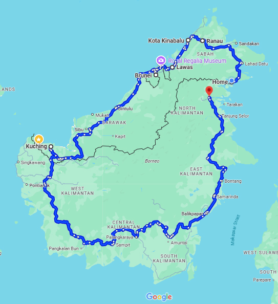
Sarawak's section of the Pan Borneo Highway, designated as Federal Route 1
(FT1), forms an extensive network that winds through the state's diverse
landscapes, connecting coastal cities with inland settlements and border towns.
The highway's southwestern terminus begins at Telok Melano near the Indonesian
border, while its northeastern extent reaches the Sungai Tujuh checkpoint
adjacent to Brunei. Along its approximately 1,077-kilometer route through
Sarawak, the highway passes through numerous significant population centers,
each contributing to the region's unique cultural and economic tapestry.
The highway's trajectory through Sarawak can be divided into several key
segments, each serving distinct regions and communities. From the southwestern
starting point at Telok Melano, the route progresses northeastward through
Sematan and Lundu before reaching Kuching, Sarawak's capital and largest city.
Kuching serves as a major transportation hub where the Pan Borneo Highway
intersects with routes leading to important destinations like the Sarawak
Cultural Village and Bako National Park. Beyond Kuching, the highway continues
through Serian, a town known for its vibrant weekend market and as a gateway to
the picturesque Bengoh Range.
Continuing northeast, the highway passes through Sri Aman, historically
significant for its fort and the natural phenomenon of the "Bening Tide" at
Batang Lupar River. The route then proceeds to Sarikei, often called the
"Pineapple Town" for its extensive fruit plantations, before reaching Sibu, a
major riverine port city on the Rajang River. Sibu represents a critical
junction where travelers can divert to explore the Upper Rajang region or
continue along the main highway route toward Bintulu.
The section between Sibu and Bintulu, completed in 1985, was historically one of
the last missing links in Sarawak's highway network. Bintulu, an important
industrial center known for its liquefied natural gas (LNG) facilities, marks
the midpoint of Sarawak's Pan Borneo Highway stretch. Beyond Bintulu, the
highway progresses through oil-rich regions to Miri, Sarawak's second-largest
city and gateway to numerous natural attractions including Gunung Mulu National
Park and Niah Caves.
North of Miri, the highway reaches the border districts of Limbang and Lawas,
which are geographically separated from the rest of Sarawak by Brunei's
territory. Limbang, situated on the banks of the Limbang River, serves as an
important administrative and commercial center, while Lawas is known for its
agricultural products and as a transit point for travel to Sabah. The Brunei
border crossings at Sungai Tujuh and Tedungan represent critical international
junctions along the Pan Borneo route, facilitating movement between Malaysia and
Brunei.
Several notable villages and smaller settlements dot the highway's path, each
offering unique glimpses into Sarawak's rural life. Batu Niah, located between
Bintulu and Miri, provides access to the spectacular Niah Caves, home to
important archaeological discoveries. Other significant villages along the route
include Marudi, a riverine town accessible by road from Miri; Belaga, though
requiring a diversion from the main highway; and numerous longhouse communities
representing various indigenous groups.
The highway's numbering system in Sarawak incorporates section codes following
the syntax "xx-yy," where "xx" represents the route number (FT1 for most of the
Pan Borneo Highway) and "yy" indicates specific sections. This system helps
travelers and maintenance crews identify particular segments of the extensive
route. Major intersections along the highway provide access to secondary roads
leading to industrial zones, agricultural areas, and tourist destinations
throughout Sarawak.
As the highway nears completion, its upgraded design features numerous
improvements over the original route, including better interchanges, rest areas,
and safety features. The full realization of this transportation corridor
promises to significantly reduce travel times between Sarawak's key cities while
improving access to previously remote communities along its path.


Major Attractions
Sarawak's Pan Borneo Highway serves as a gateway to some of Malaysia's most spectacular natural wonders and cultural treasures. The highway's improved accessibility has made it easier for travelers to explore the state's diverse attractions, ranging from UNESCO World Heritage sites to traditional indigenous communities. These destinations showcase Sarawak's rich biodiversity and multicultural heritage, offering unforgettable experiences for both domestic and international visitors..
 Gunung Mulu National Park
Gunung Mulu National Park, a UNESCO World Heritage Site, stands as one of Sarawak's crown jewels accessible via the Pan Borneo Highway. Located near Miri, this park boasts the world's largest cave chamber (Sarawak Chamber), breathtaking limestone pinnacles, and extensive cave systems including Deer Cave and Clearwater Cave. Visitors can explore 1.6-billion-year-old underground river channels, walk the 480-meter-long rainforest canopy skywalk (the world's longest tree-based suspension bridge), and witness the spectacular bat exodus at dusk. The park's biodiversity includes countless species of flora and fauna, many endemic to Borneo.
Explore
 Niah Caves
The Niah Caves, located near Batu Niah between Bintulu and Miri, represent one of Southeast Asia's most important archaeological sites. These massive limestone caves have yielded evidence of human habitation dating back 40,000 years, including the famous "Deep Skull" discovered in 1958--the oldest modern human remains found in Southeast Asia. Visitors can explore the caves' cathedral-like chambers adorned with ancient cave paintings while learning about their significance in understanding early human migration patterns.
Explore
 Sarawak Cultural Village
The Sarawak Cultural Village, located near Kuching, offers an immersive introduction to the state's ethnic diversity. Dubbed a "living museum," the village features authentic replicas of traditional dwellings from various indigenous groups including Iban longhouses, Bidayuh bamboo houses, and Orang Ulu settlements. Visitors can witness cultural performances, traditional crafts demonstrations, and sample indigenous cuisines. The village hosts major events like the World Harvest Festival and Rainforest World Music Festival, which attract international audiences.
ExploreTravel Guide for Self-Driving
Embarking on a self-drive adventure along Sarawak's Pan Borneo Highway offers unparalleled freedom to explore Malaysia's largest state at your own pace. However, the journey requires careful planning to ensure safety, comfort, and maximum enjoyment of the diverse landscapes and cultures along the route. This practical guide provides essential information for travelers considering a road trip along this transformative highway.
Essential Travel Tips
- Best Time to Travel: April-September (dry season)
- Vehicle Recommendation: Sedan or SUV sufficient for main highway
- Fuel Stations: Available every 50-100km in populated areas
- Border Crossings: Valid passport and vehicle documents required
- Safety: Be cautious of wildlife crossings in forested areas

Self-Drive Itineraries
For travelers with limited time, focusing on key segments of the highway
provides rewarding experiences:
Kuching to Miri (Approx. 800 km, 8-9 hours driving time)
This route covers Sarawak's most developed regions, passing through:
- Serian (60 km from Kuching): Stop for local fruits at the weekend market
- Sri Aman (150 km further): Witness the tidal bore phenomenon if timing aligns
- Sibu (300 km from Sri Aman): Explore the bustling riverfront and try Foochow
cuisine
- Bintulu (200 km from Sibu): Visit the oil and gas industry center
- Miri (200 km from Bintulu): Gateway to Gunung Mulu National Park and Niah
Caves

Accommodation Guide
The Pan Borneo Highway offers varied lodging options:
City hotels (Kuching, Sibu, Bintulu, Miri):
- International chains (Hilton, Pullman, Merdeka Palace)
- Mid-range business hotels
- Budget accommodations
Small town guesthouses (Sri Aman, Sarikei, Limbang):
- Basic but clean rooms
- Local character and hospitality
- Often family-run
Nature-based accommodations (near national parks):
- Mulu Marriott Resort (for Gunung Mulu National Park)
- Bako National Park accommodation
- Homestays near Niah Caves
Indigenous experiences:
- Iban longhouse stays (typically require advance arrangement)
- Bidayuh village homestays
- Orang Ulu cultural immersion programs
Cultural Context
Sarawak's Pan Borneo Highway traverses a cultural landscape as diverse and vibrant as its natural environment. The state is home to over 40 ethnic groups, each with distinct traditions, languages, and ways of life that have evolved in harmony with Borneo's rainforests for generations. As the highway improves accessibility to previously remote regions, it brings both opportunities and challenges to these indigenous communities while offering travelers unparalleled cultural immersion experiences.

Indigenous Communities
The Pan Borneo Highway connects travelers with Sarawak's main ethnic groups:
Iban: Forming the largest indigenous group (28.87% of Sarawak's population),
the Iban are traditionally known as formidable warriors and skilled rice
farmers. Their communal longhouses--some accessible via the highway or short
diversions--remain central to social organization. The Iban are renowned for
their intricate beadwork, woven pua kumbu textiles, and vibrant Gawai Dayak
harvest festivals.
Chinese: Comprising 23.37% of the population, Sarawak's Chinese community
(predominantly Foochow, Hakka, and Hokkien) has significantly influenced the
state's commerce and cuisine. Cities along the highway like Sibu and Kuching
showcase Chinese heritage through temples, kopitiam (coffee shops), and annual
celebrations like the Hungry Ghost Festival.
Malay: Making up 22.99% of Sarawakians, the Malay community contributes the
state's Islamic cultural heritage. Their traditional villages (kampung) along
riverbanks feature distinctive wooden houses and mosques. Malay influence is
particularly evident in Sarawak's culinary traditions and political
institutions.
Bidayuh: Concentrated in southwestern Sarawak near Kuching, the Bidayuh
("land people") are known for their roundhouse architecture and bamboo-based
crafts. Many Bidayuh villages have transitioned to modern housing while
maintaining cultural traditions.
Orang Ulu: This collective term ("upriver people") encompasses numerous
smaller groups like the Kayan, Kenyah, Kelabit, and Lun Bawang. Living in
northern Sarawak's interior, they're renowned for intricate beadwork, sape
(lute) music, and elaborate tattoos. The highway provides improved access to
their traditional territories.

Festivals & Traditions
The highway provides access to Sarawak's vibrant festival calendar:
Gawai Dayak (June 1-2): The most important harvest festival for Iban and
Bidayuh communities, featuring tuak (rice wine) ceremonies, traditional dances,
and elaborate rituals. Many longhouses welcome visitors during this celebration.
Rainforest World Music Festival (usually July): Held at the Sarawak Cultural
Village near Kuching, this internationally renowned event showcases indigenous
music alongside global acts.
Chinese New Year (January/February): Particularly vibrant in Sibu and
Kuching's Chinatowns, with lion dances, open houses, and special foods.
Kaul Festival (April): The Melanau people's traditional thanksgiving
ceremony featuring unique giant swing rituals and traditional costumes.

Arts & Handicrafts
Discover the traditional crafts and artistic heritage of Sarawak's communities.
Read More