
Engkilili Town
英吉利里
Kuching 156 Km
SARAWAK > 2ND DIVISION SRI AMAN > Engkilili Town
Engkilili Town
英吉利里
Kuching 156 Km
Engkilili town is 156kilometres (97.0 mi) from Kuching City. A quiet town in the
district of Lubok Antu, Sri Aman Division.
Engkilili bazaar was first established in 1888. And by 1920, there were 12
attap shop-houses in the bazaar.
The name of Engkilili was derived from a local fruit which was found in
abundance in the olden days the "Engkilili Tree"
The Engkilili tree (Lepisanthes alata) is commonly known as pokok ceri
Terengganu or Malay cherry.
The tree can grow up to 15m high with flowers that come in purple to reddish
brown.
Engkilili tree can also found in Sumatra, Java and Peninsular Malaysia.
Hakka Chinese Settlements in Engkilli.
According to history in 1854, a group of Hakka came to Engkilili from Pontianak
and Sambas in Kalimantan, Indonesia.
Led by Bong Chie, the group came through Tebedu, through Tebekang to Engkilili.
These Hakka Chinese were originated from China's Tapu, Chia Ying, Huilai and
Kityang in Kwantung Province of China.
According to Sarawak Gazette, in September 1870 there were 450 Chinese settled
down mainly at Marup, Engkilili.
In the 1870s, the gold mining industry was booming in Marup. The gold miners
formed the Fifteen Kongsi at Marup to run their daily administration.
Then in 1917, another wave of Chinese immigrants came to Engkilili. They are the
Teochews Chinese who profession mainly as traders at the bazaar.

SRB Chung Hua Engkilili
英吉利里中華公學
The visit of Italian botanist Odoardo Beccari
The Fifteen Kongsi had a house which also functioned as the
administration office, gathering space, as well as guesthouse.
An earliest records of Marup from the 19th century was written by Italian
botanist Odoardo Beccari.
He lived in Borneo from 1865 to 1868. His three years of Borneo experiences were
recorded in his book "Wanderings in the great forests of Borneo, travels and
researches of a naturalist in Sarawak (1904)"
Beccari wrote the early description of Marup : “Marop is a Chinese village,
placed in a small valley surrounded by low hills. The stream from which it takes
its name runs through it, supplying an abundance of cool limpid water, and
giving off a minor torrent which dashes merrily amidst the houses. The village
was very clean; most of the houses were made with mats or palm leaves, but the
big house, or residence of the Kunsi, the headman of the Chinese, in which I
took up my quarters, was almost entirely built by wood.”
Beccari also noted that Marop was an excellent station for a zoologist but a
poor one for a botanist. This was because the forest in the area had been mostly
cleared for paddy planting.
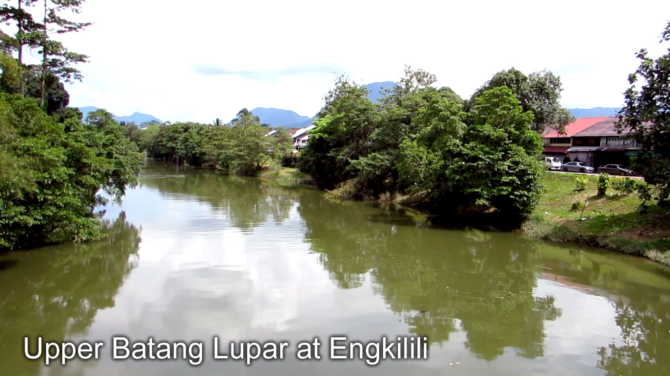
Upper Batang Lupar at Engkilili
Batang Lupar flows 275 kilometers from the Klinkang Range to the South
China Sea.
It has a large rivermouth and becomes shallow upstream.
The river runs through a number of towns including :
1- Lingga
2- Sri Aman
3- Engkilili
Batang Lupar river is the only river in Malaysia which experiences the tidal
bore phenomenon. The Tidal Bore only happen at the Lower Lupar River at Sri Aman
town.
Though Tidal Bore happens everyday, it becomes more spectacular at king tide
during dry season.
Engkilili Town

Tua Pek Kong Temple
英吉利里福德祠大伯公廟
Engkilili Town is 260 km from Kuching (3 hours drive)
This new Engkilili Tua Pek Kong Temple is Rm2 million took 2 years to built. The
new temple is an icon in the town centre. The older one more than 100 years ago
was by the river bank and can be seen as soon as the boat come into town.
There are more than 70’s Tua Pek Kong temples in Sarawak and these are the
earlier Chinese points of worshipping and communal activities when they first
settled in Sarawak.
The rise and fall of Fort Leonora
Like most settlements built during the reign of the White Rajahs of Sarawak,
Engkilili has its own fort.
However unlike most Brooke’s forts which were built for defence purposes, the
one in Engkilili was designed as an administration office.
Built in 1924, the fort was named Fort Leonora after Vyner’s eldest daughter,
Dayang Leonara Margaret.
Since it was built, the fort served different purposes over the years. When the
Japanese took over Sarawak during World War II, the fort was used as the
kempeitai’s office.
Then during the colonial period, the British colonial officers used it as their
office. Later during Indonesia-Malaysia Confrontation, Fort Leonora was turned
into an army base for the Commonwealth forces.
Despite its rich history, the original building was torn down and was rebuilt.
Today it is the Engkilili Sub-District Office.
The only known photo of Fort Leonora belonged to Brian Houldershaw which was
taken in 1965.
RELATED TOPICS
|
|
SARAWAK |