Wednesday, 08 August, 2018 08:50:19 PM
Source : www.townplanning.sabah.gov.my
1 Rapid Survey of Development Opportunities & Constraints
(DOC) for Tawau District
Dates of Survey – 30 March 1999
1.1 Existing Situation
1.2 Constraints and Opportunities
1.3 Development Directions

1.1.1 Background Information

沿岸地区 ICZM area
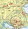
The district of Tawau has a coastal zone area of 1,771km 2, much of it
concentrated around the narrow coastal areas at the southern part of the
district. Some 70% of Tawau are high hills and mountainous.


人口 Population
The 1991 official statistics stated that the population of Tawau was 244,728
making it the highest populated district in Sabah. It is expected to grow to
649,180 in 2005, and increase of 165.3%. The huge increase in population is
partly due to the influx of illegal immigrants from neighbouring countries,
particularly the Philippines and Indonesia. However no exact statistical
data are available.
The urban population too is expected to increase from
124,943 to 482,758 people. However the preferred strategy is to decrease the
urban population to 400,000.
|
1991 |
Trend 2005
|
Preferred 2005
|
||
|
Total Population
|
244,728
|
649,180
|
649,180
|
|
|
Urban Population
|
124,943
|
482,758
|
400,000
|
|
|
Rural Population
|
119,785
|
166,422
|
249,180
|
|
|
Urban Development
1991-2005 : 1,650 ha.
|
Of which 1,238 ha.
Prime Agricultural Land
|
|||
Source: 1991 Census & ICZM Working Group

规划 Planning Schemes
The Tawau Local Plan serves as a planning guide to the development of
urban Tawau. However no planning scheme for the whole district was
available for inspection.
1.1.2 Physical

地势 Topography
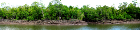
Most of the topography on the western portion of the coastal areas is tidal swamps and terraces caused by the many rivers such as the Kilabukan, Brantian and Merotai rivers that flow through to Cowie Harbour. The eastern portion of the coastal zone consists mostly of terraces and tidal swamps and floodplains, some moderate hills and sand beaches along the southern coast.
A unique basin-hill like landmark is found approximately 10km west of
Merotai Besar. It is within the wildlife reserve. However not much is
known about the hill.

植物环境 Vegetation and Environment
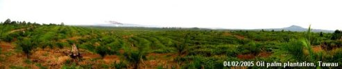
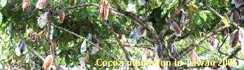
Oil palm and cocoa are the major tree crops in Tawau. Oil palm is concentrated along the roads to Merotai up to Brantian and along the roads to Semporna and Kunak. Cocoa is mostly concentrated in the interior north of Tawau town. Cocoa plantations are however decreasing.
Other typical vegetation consists of:
1) Fruit trees 2) Bananas
3) Coconut 4) Rubber

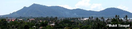
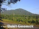
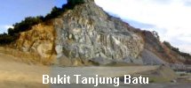
Most of Tawau is fertile especially areas away from the tidal swamps and the high hills. As a result areas not gazette as forest reserves are likely to be cultivated. Few of the hills around Tawau however are being protected as a forest protection area such as at Bukit Gumok, Bukit Tinagat and Bukit Tanjung Batu. Bukit Gumok in particular is protected as a recreational park but surrounded by palm oil plantations. However Bukit Tanjung Batu is half quarried.
1.1.3 Development

开发中心 Growth centres
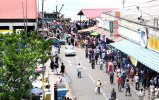
Tawau town is the major urban centre for the south-eastern region of Sabah.
It is particularly active in barter trading especially with neighbouring
Indonesia at Nunukan. Despite the large urban population, Tawau town faces
less traffic congestion compared to other urban centres in Sabah partly due
to the grid pattern of roads. Tawau town too has plenty of development land
especially on the reclaimed part of the town.
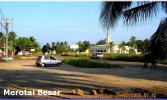
Other growth centres are at Merotai Besar and Kalabakan. Wallace Bay at
Pulau Sebatik too is being planned for an integrated port complex to cater
for barter trading.

住宅 Settlement
Most of the settlements in Tawau occur along roads and in growth centres.
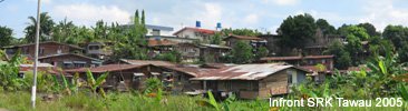
Illegal squatter dwellings, (a major issue in
Tawau) are found along the coast and river mouth. There are about 18 illegal
squatters’ areas around Tawau town alone. Kg. Titingan or the “Ice Box” and
Hidayat are the largest of all. Besides settling along the coast, some of
them reside in most unsafe areas such as at the end of the Tawau airport
runway.
Two army camps are also found in Tawau; Kokosan (32.4
hectares) and Kobota (80.9 hectares).

基础架设 Infrastructural
Accessibility to basic infrastructure (Roads, water and electricity) is
basically good except in the rural areas. This is partly because of the
scattered settlement patterns and funding. However there is a major plan to
improve road linkages between Kalabakan and Pensiangan.
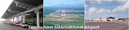
A new airport is currently being constructed at Km28 Jalan Apas. It is due
to be completed by end of 2000. To cater for the increasing traffic volume,
a dual carriageway is to be built right up to the airport.
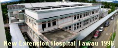
To cater for the increasing health services, the
HOSPITAL has been expanded and a new nursing school has been opened.

经济 Economic
Agriculture is the major economic activity of Tawau particularly the oil
palm and cocoa plantation. The Majulah Cocoa factory in Tawau for instance
is said to be the biggest in Malaysia.

Forest related industries are still active in Tawau
especially in the Tanjung Batu areas. There are also some logging activities
south of Tawau within the interior of Serudong.
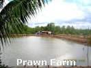
Fisheries particularly aquaculture too plays an important part of Tawau’s
economy. The Prawn farms at Batu Payung are said to be the biggest in Sabah.
Most of the products are exported overseas.
The tourism industry particularly eco-tourism is
increasingly popular in Tawau. Although the attractions may not be in Tawai
itself, Tawau is used as a transit for the popular destinations of Pulau
Sipadan and Mabul in Semporna.

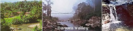
Other potential attractions are the beautiful Forest Centre at Luasung near Danum Valley.
Barter trade has been a traditional economic activity between Tawau and its neighbouring countries particularly Nunukan in Indonesia. Immigrant movement as a result from this activity is said to be under control.
More about Development in Tawau District
|
|